|
#3278392 - 04/24/11 07:58 AM
 Re: Printable map ?
[Re: tmahring]
Re: Printable map ?
[Re: tmahring]
|
Joined: Apr 2011
Posts: 5
Jarsalla

Junior Member
|
Junior Member
Joined: Apr 2011
Posts: 5
Finland
|
Last edited by Jarsalla; 04/24/11 07:59 AM.
Formerly known as Stuka here when B-17 Flying Fortress II was released back in the year 2000, followed by BOB and IL-2. Since those days I have forgotten my password and my email has changed, doH!
|
|
|
#3278426 - 04/24/11 11:52 AM
Re: Printable map ?
[Re: tmahring]
|
Joined: Jun 2010
Posts: 77
xnomad
Junior Member
|
Junior Member
Joined: Jun 2010
Posts: 77
Sydney, Australia
|
I guess that's a no as the Russian link doesn't seem to work (can anyone else actually get the file to download) and it doesn't look detailed enough for navigation. The BOB one is $18.
i5-2500K / P67A-UD3-B3 / GTX 560TI 1GB 900MHz OC
2 x 4GB DDR3 1600MHz RAM / Samsung 500GB Spinpoint F3 7200rpm / Antec TP 750 PSU / Win 7 HP 64bit / TrackIR 5 / MSFFB2 / CH Pro Throttle / CH Pro Pedals
|
|
|
#3278516 - 04/24/11 03:30 PM
Re: Printable map ?
[Re: tmahring]
|
Joined: May 2001
Posts: 1,101
jocko-
Member
|
Member
Joined: May 2001
Posts: 1,101
Georgetown, ON Canada
|
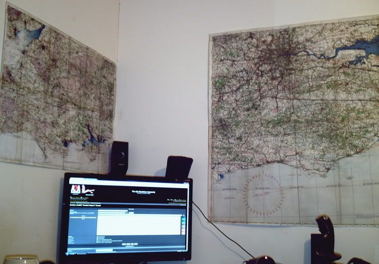
If you use Kegety's SFS mod and set up a dump folder you can extract all the tiles used by the game for the map view, they are in tga format, and are 256x256. If some bright spark knows how to assemble them all I would think a RoF style pdf map could be made. Sample tile in jpg format: 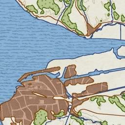 When I played the Manston portion of the RAF career I took a screen shot of the area and added a layer with airfield symbology and place names like a RL 1940 map I have (that I don't use given it's age): 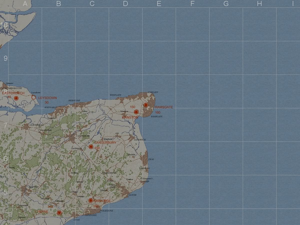 Smaller than actual size due to Photobucket compressing it.
Cheers!
jocko-
417 RCAF
|
|
|
#3278535 - 04/24/11 03:46 PM
Re: Printable map ?
[Re: Deathwing67]
|
Joined: May 2010
Posts: 3,812
JAMF
Frugalite & P-38 fan
|
Frugalite & P-38 fan
Senior Member
Joined: May 2010
Posts: 3,812
The Netherlands
|
.... authentic to the period,.. So they are not that well suited for CoD, with their unauthentic in-game map.
|
|
|
#3278700 - 04/24/11 08:20 PM
Re: Printable map ?
[Re: tmahring]
|
Joined: Apr 2011
Posts: 10
LLv26_Ozz
Junior Member
|
Junior Member
Joined: Apr 2011
Posts: 10
|
Im working on map from the game. Found things to help automate some stuff but still lots of stuff to do manually. When I get that whole map made (width is about 11000 pix) then biggest work is to get those airfields (+airfield names) in correct places. When all that is done I have BIG pic from the game map. I thought TO convert it to PDF so for everyone can easily print and clue those pages together. BUT Im wondering the size? How many pages u wanna clue together? Or should I make some more accurate maps from some parts of the map or what? OK lets found out how big that will be when I get that done and then we will think sizes etc... Accuracy of the map is a bit too accurate...? But lets thing that when I have done this.  AND SORRY ABOUT MY ENGLISH... ITS A BIT RUSTY....
Last edited by LLv26_Ozz; 04/24/11 08:21 PM.
|
|
|
#3278722 - 04/24/11 08:50 PM
Re: Printable map ?
[Re: jocko-]
|
Joined: Jan 2009
Posts: 4,737
FearlessFrog
Senior Member
|
Senior Member
Joined: Jan 2009
Posts: 4,737
|
If you use Kegety's SFS mod and set up a dump folder you can extract all the tiles used by the game for the map view, they are in tga format, and are 256x256. If some bright spark knows how to assemble them all I would think a RoF style pdf map could be made. Sample tile in jpg format: When I played the Manston portion of the RAF career I took a screen shot of the area and added a layer with airfield symbology and place names like a RL 1940 map I have (that I don't use given it's age): Smaller than actual size due to Photobucket compressing it. You know Jocko, a download version of the Manston area plus a couple of others north/south of that with airfield symbols would be great - we probably don't need much more than that at the moment. Do you have any more examples? 
|
|
|
#3278792 - 04/24/11 10:54 PM
Re: Printable map ?
[Re: FearlessFrog]
|
Joined: May 2001
Posts: 1,101
jocko-
Member
|
Member
Joined: May 2001
Posts: 1,101
Georgetown, ON Canada
|
@FearlessFrog: Hehe, yeah I'll see what I can do. What I think would be great is separate pdf map that could be open on a touchscreen display or iPad or something. Then we could move it around and zoom without having to open another window in the game.
There are over 1200 tiles so the entire map is a huge file. I think Ozz is moving in the right direction.
Cheers!
jocko-
417 RCAF
|
|
|
#3278796 - 04/24/11 11:03 PM
Re: Printable map ?
[Re: LLv26_Ozz]
|
Joined: Jan 2009
Posts: 4,737
FearlessFrog
Senior Member
|
Senior Member
Joined: Jan 2009
Posts: 4,737
|
Now I have map about 11000x10000.
Im working on to get those airfields there.
But now I have to go sleep! (clock is here 1:10) If you get to a state of a big image with some decent labels for airfields etc then give us a shout - I can quickly write a mini web app to make it zoomable a la google maps.
|
|
|
#3278914 - 04/25/11 02:19 AM
Re: Printable map ?
[Re: tmahring]
|
Joined: Jun 2003
Posts: 916
IvanK
Member
|
Member
Joined: Jun 2003
Posts: 916
Aus
|
Working on it:)..... no requirement to use ANY SFS extraction stuff either. Its about 4900 x 4000 pixels.  A higher detail segment  Black lines are the railways. Also includes the standard RAF "Purple" grid
Last edited by IvanK; 04/25/11 09:05 AM.
|
|
|
#3278953 - 04/25/11 03:46 AM
Re: Printable map ?
[Re: tmahring]
|
Joined: May 2001
Posts: 1,101
jocko-
Member
|
Member
Joined: May 2001
Posts: 1,101
Georgetown, ON Canada
|
Hey IvanK, nice job adding the railways (iron compass), the purple grid looks just like the one on my RL map. When the map is done will you offer a psd with all the different layers? I'd prefer to add my own airfield dots instead of using the white ones the game uses, I find them too clunky looking.
Cheers!
jocko-
417 RCAF
|
|
|
|
|
|
|
|
|
|
|
|
|
Exodus
by RedOneAlpha. 04/18/24 05:46 PM
|
|
|
|
|
|
|
|
|
|